
The Principal Trail
Please be aware that along some roads there are no pavements and at times footpaths may be uneven or muddy – sturdy footwear or wellies are recommended. Please keep dogs on leads and help keep Britain tidy by taking your litter home or finding a bin on-route. Walking times are provided as a guide.
Cyclists – we have aimed to find routes that are suitable for cycling but at times you may be required to dismount along some sections. On shared routes please give way to pedestrians and take care when overtaking.
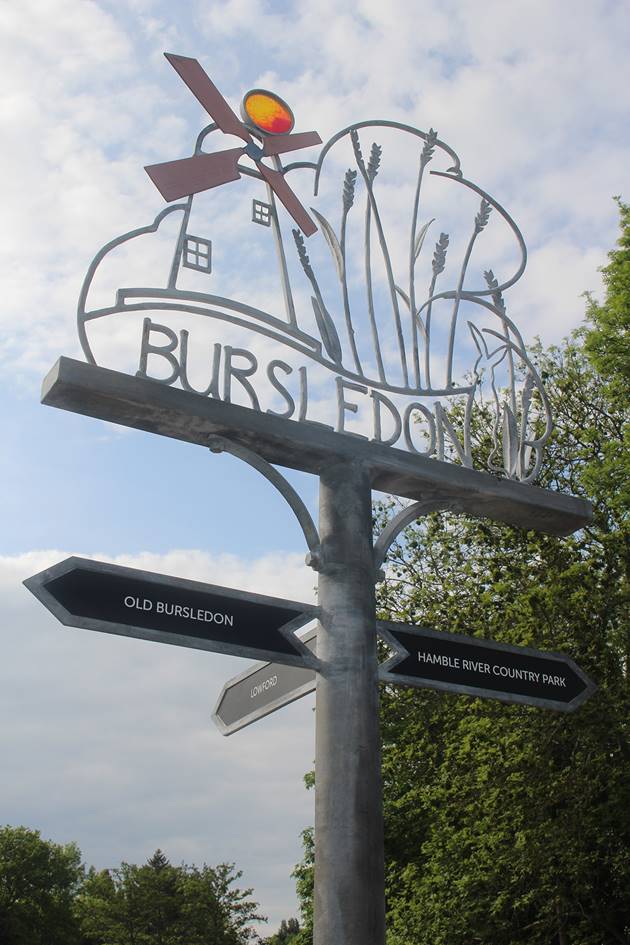
Starting at Bursledon Station - 2 mins
Exit Bursledon Station, where you will see the Bursledon Parish Post and turn right to pass through the car park entrance. Join the footpath on your left hand side at mini marker I which will lead up a short but steep hill to join Station Hill.
Cyclists - Please join Station Road and turn left, this will take you up a short but steep hill to join Station Hill. You will pass mini marker J on the right which marks the footpath leading to Bursledon Recreation Ground and Bursledon Windmill.
For lovely views of the marina travel along Lands End Road (3 min walk), passing the entrance to the Jolly Sailor public house, which takes you to a small pebble beach with a public access landing point (additional 6 mins walk).
Bursledon Station to Marker Post 11 - 5 mins
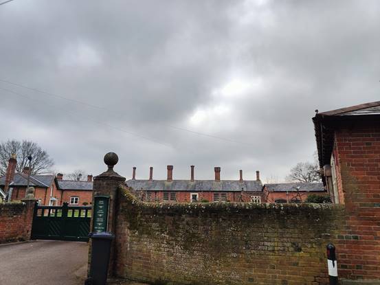
Continue along Station Hill and High Street, be sure to keep an eye out for some impressive chimneystacks and Marker Post 11 - Old Bursledon. There is a resting place at the junction of High Street and School Road with a view towards the river.
Marker Post 11 to Marker Post 10 - 12 mins
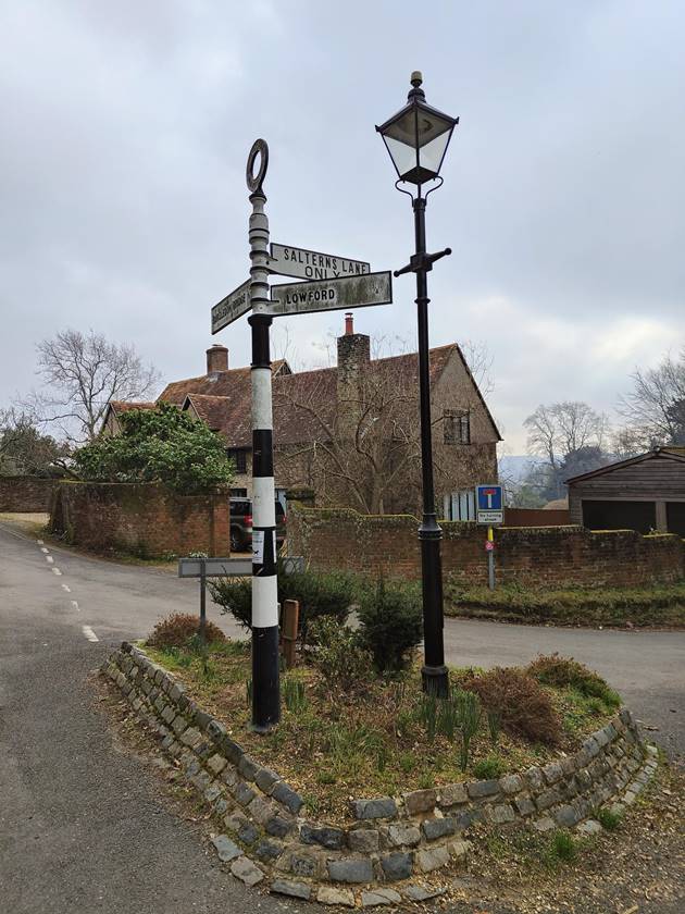
Continue the walk along High Street, passing the old Post Office and The Vine Inn until you reach the Salterns Lane junction.
At this point you may wish to venture down Salterns Lane and join the footpath which takes you under the railway line and out onto the riverbank (4 mins walk). Giving you a wonderful view of the Hamble and surrounding marinas.
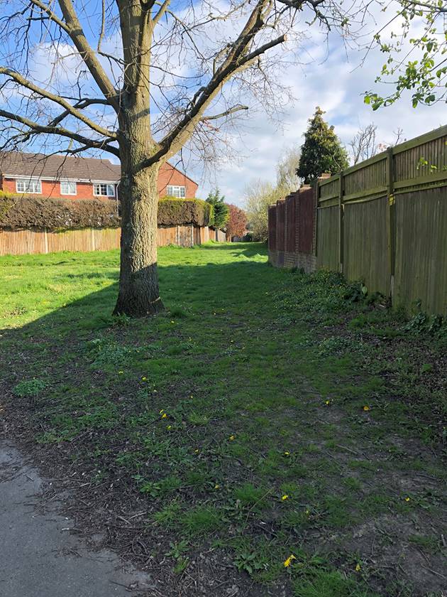
If continuing along the Principal Trail, travel straight onto Kew Lane for a short distance. As Kew Lane curves to the right, leave the road and join the footpath which can be found on the righthand side of the gravelled access. There is a gentle downhill slope and the footpath is uneven at points, please watch your step.
Join Hungerford and after approximately 80m take the footpath on the left, which will lead you downhill into the woodland of Mallards Moor. You will pass over a small stream after which point the path will lead you uphill, veer left and walk along the ridge until you meet a concrete path where you will find Marker Post 10 Mallards Moor.
Marker Post 10 to Marker Post 9 – 7 mins
Turn right and cross the path to re-join the route within a few meters, this section of the route is a bridleway. After 180m the bridleway will make a sharp left turn, continue for approx. 160m to mini marker H.
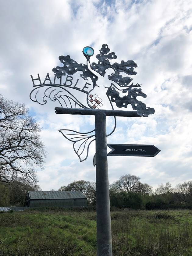
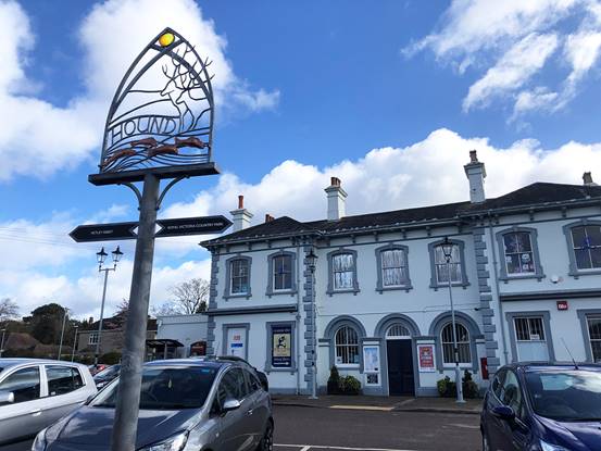
At this point, Hamble Station is a short walk away (10 min walk) via the supporting trail, where you can see the Hamble Parish Post
Continue south along the path, crossing the railway line, and the path will join Satchell Lane, where you will find Marker Post 9 Satchell Lane.
Marker Post 9 to Marker Post 6 – 20 mins
Turning left, walk south along Satchell Lane, please be aware that there are no pavements along this section of the road.
After the bend join the footpath on the southern side of the road that runs along the edge of Hamble Airfield.
At Marker Post 6 Hamble Airfield you can either walk south to Hamble Foreshore or turn west and continue along the Principal Trail towards Netley.
Marker Post 6 to Marker Post 7 - 8 mins
To Hamble Foreshore
Continue along the footpath which will turn southeast and emerge onto Satchell Lane. Turn right and head south along Satchell Lane until the junction with High Street, where you will pass the Royal Mail golden post box in honour of famous local Dani Rowe (was King), Olympic gold medallist for cycling in the women’s team pursuit at the London 2012 Olympic Games. Walk down the narrow and twisty High Street, passing local shops, bars and restaurants and on to The Quay, where you will have a wonderful view of the waterfront and moorings.
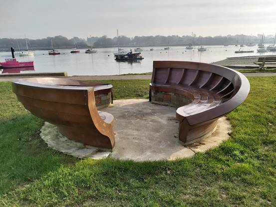
Pass the car park ahead and you will find yourself on the waterfront, turn right and you will pass the nautical seating designed by Tim Norris where you can watch the boats. Opposite you will mostly likely see one of the distinctive Hamble to Warsash pink ferries, they’re hard to miss! When you are ready, proceed along the waterfront, passing the lifeboat launch and the Beach Hut Café. Marker post 7 Hamble Foreshore can be found just past the next slipway.
Marker Post 7 to Marker Post 6 – 13 mins
To continue to Marker Point 8 Hamble Point join Green Lane, otherwise retrace your steps along High Street and Satchell Lane back to Marker post 6 Hamble Airfield.
Marker Post 6 to Marker Post 5 - 12 mins
To Netley
Turn right and walk along the southern edge of the parish playing fields, heading towards the Roy Underdown Pavillion. Exit through the main gate with the car park on the righthand side and join the Hamble Rail Trail where you will find mini marker G.
Follow the Trail northwards, walking alongside the disused railway track which was built towards the end of WW1 to transport aircraft from Manchester to Hamble, the war ended before the line was completed so it was sold off for the transportation of oil and was decommissioned in 1986. The Trail meets Hamble Lane, where you will find Marker Post 5 Hamble Rail Trail.
Marker Post 5 to Marker Post 4 - 3 mins
From Marker Post 5 Hamble Rail Trail travel south on a section of the Dani King Cycle Way, a shared use path that runs along Hamble Lane for 150m to the Pelican crossing, cross over and continue south for 90m to Marker Post 4 Hamble Lane.
Marker Post 4 to Marker Post 3 – 5 mins
Turn right and follow the tarmac path, part of the National Cycle Route 2. At the far end, the footpath continues straight between trees, whilst the cycleway turns briefly right and back on itself, meeting the footpath at the bottom of the slope by Marker Post 3 RVCP Military Cemetery.
Marker Post 3 to Marker Post 2 – 12 mins
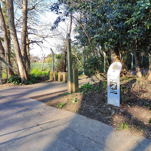
From here you can turn right to visit Netley Military Cemetery, otherwise continue straight along the path through the woodlands to Royal Victoria Country Park arriving at mini marker D next to the gate.
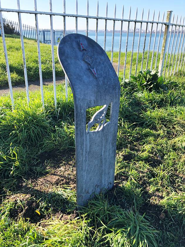
Just ahead of you on the lawn you will see one of the six interpretation points relating to the history of the Royal Victoria Hospital. Four of the structures including this one mark the corners of the main building of the hospital.
Turn left and continue to mini marker C, turning right here to walk along the avenue which passes in front of the Military Hospital Museum and you’ll find Marker Post 2 Royal Victoria Country Park just before the road.
Marker Post 2 to Marker Post 1 – 20 mins
From Marker Post 2 Royal Victoria Country Park cross over the zebra crossing and follow the gravel path along the edge of the sports pitches. The cycle path joins the road on the right, walkers may prefer to stay on the grass until meeting the entrance/exit of Royal Victoria Country Park.
Continue ahead to join Victoria Road, passing mini marker B on the left-hand side and views across Southampton Water to Fawley Power Station. Follow the Coast Path along the side of the road through Netley, passing the boatyard, The Prince Consort public house on the right and various cafes and small businesses.
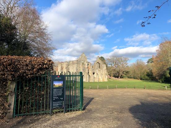
When the Coastal Path turns left towards the waterfront continue ahead, passing a colourful row of terraced houses overlooking the Cricket Field. Marker Post 1 Netley Abbey is on the opposite side of the road next to the small car park.
Marker Post 1 to mini marker A – 3 mins
To continue in a loop around the Abbey to Netley Station, cross from Marker Post 1 Netley Abbey to the other side of Victoria Road and continue up Victoria Road, passing the Abbey on your right. As the road bends to the left you’ll find mini marker A on the right.
Mini marker A to Netley Station - 35 mins
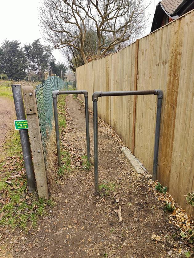
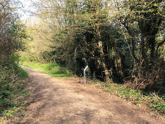
Turn right to follow the footpath along the lane towards Fountain Park for 75m, turning into the woods just before the gated entrance. Take care on this trail through the woods where the path is uneven and depending on recent weather, can be muddy.
After following the path alongside the fenced paddock, take the right at the first fork then after another 80m keep right again, travelling towards Marker Post 15 Westwood Park as the tree cover opens up. Follow this track through Westwood Woodland Park, curving right. At the end of the track you’ll reach the kissing gate by Woodside Court. Go through it and turn immediately left to follow the road over the railway line.
Just beyond the Grange Way bus stop cross the road and continue to the junction, turning right onto Ingleside. Cross over onto Woolston Road and follow the footpath as it follows the road curving right. At the first mature tree tree turn right and follow the grass corridor between the fences and walls of back gardens until you reach the first lamppost over the tarmac path. Turn right and walk along the footpath to the third lamppost then turn left into The Bunney.
Follow the path all the way through woodland, taking left options at forks and passing the Southern Water tank until you reach the historic ornamental planting (from a Victorian estate on this site) of bamboos and rhododendron.
On reaching the finger post showing the permissive path arrow take the left fork then bear right to come up the steep steps and arriving by mini marker N at the top.
Cross over to the other side of Ingleside and follow the footpath along Hound Way ahead of you, crossing again immediately at the pedestrian island. Turn left onto St Mary’s Road.
Take care along this road where there’s no pavement, being especially cautious at the bend. Turn right onto the road signposted Oakhurst Way and you’ll see the gate to Platform 2 of Netley Station directly ahead. A footbridge across to Platform 1 and the ticket office is to the left.